Predict Yields.
Detect Stress.
Optimize Every Acre.
Agrocept combines satellite intelligence, machine learning, and agronomic science to help farmers maximize yields, reduce input costs, and grow sustainably.

Powerful Features for Modern Farming
From space to soil — actionable insights at your fingertips.
Satellite Crop Monitoring
Sentinel-2 & Landsat integration for NDVI, thermal, and spectral analysis at field-level resolution.
AI Yield Prediction
Machine learning models trained on LUCAS soil data with 90% prediction intervals for confident decisions.
Soil Nutrient Mapping
Predict N, P, K, and pH from satellite reflectance — 10m resolution, no lab required.
Soil Moisture & ET
LST-NDVI trapezoidal method (TVDI) for volumetric water content, plus NASA POWER evapotranspiration.
Smart Inventory
Track fertilizers, pesticides, and supplies. Auto-schedule applications based on crop needs.
Economic Analysis
ROI calculations, yield gap decomposition, and cost optimization recommendations.
Every Insight. One Platform.
Real screenshots from Agrocept — built for real farms, real crops, real decisions.
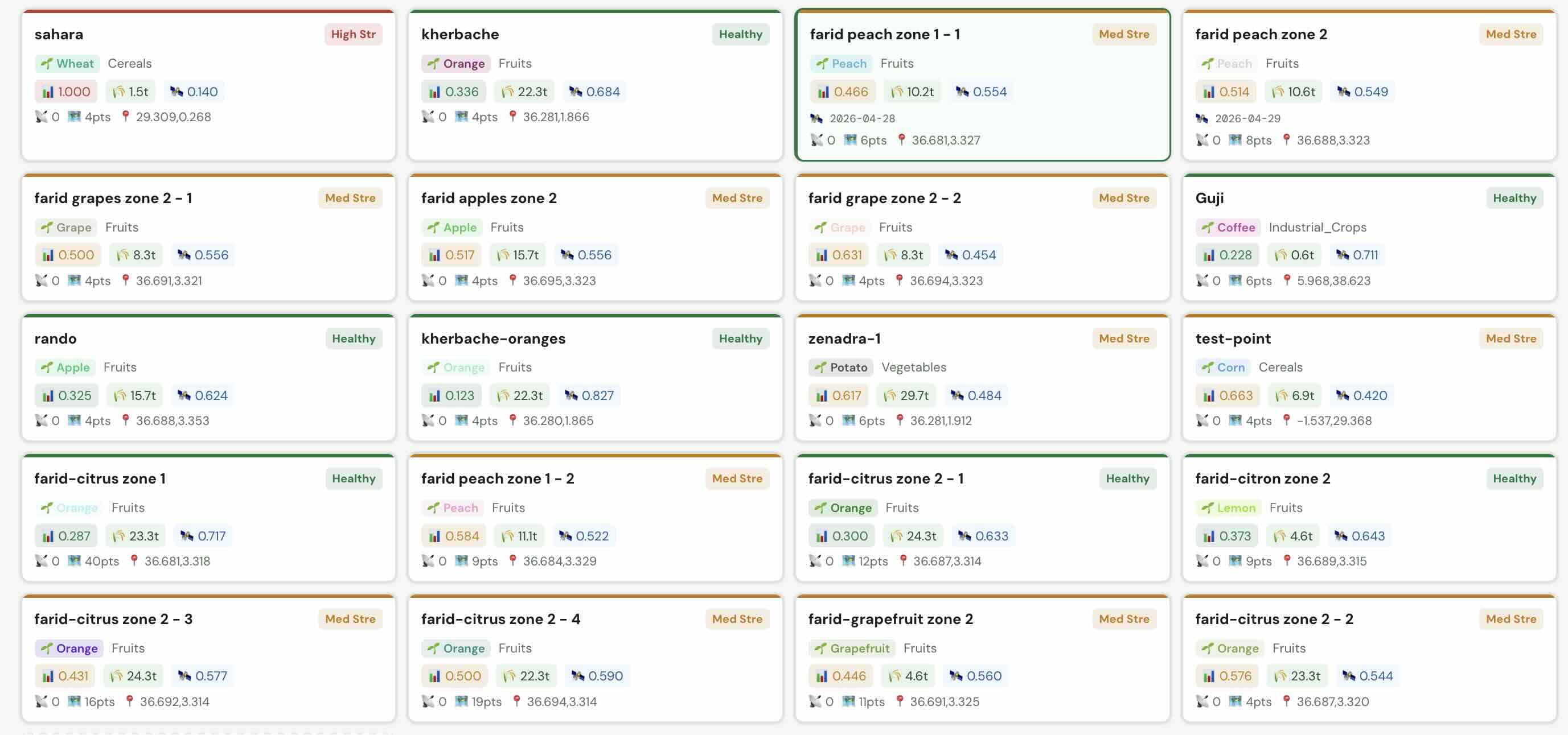
All your farms, at a glance
Scan every field's stress index, yield forecast, and NDVI in one card grid. Healthy farms in green, stressed ones flagged amber or red — spot problems before they cost you.
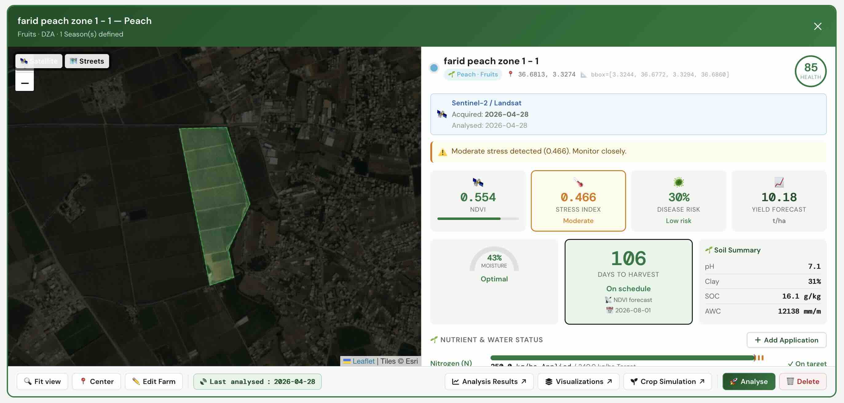
Complete agronomic picture in one card
Yield forecast, disease risk, NDVI, stress index, soil pH, clay content, SOC, days to harvest — plus upcoming NPK application dates and targets. Everything to act today.
20+ spectral layers. One map.
Switch between NDVI, soil moisture, chlorophyll, LAI, crop stress, and more — each with a live interpretation guide showing what the colors mean and when to act.
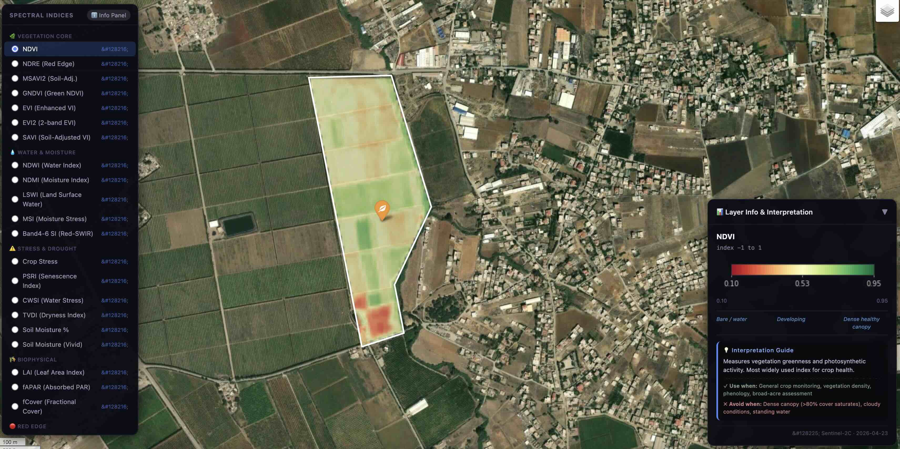
Red = stressed or bare. Green = dense healthy canopy. At-a-glance spatial map for whole-field crop health.
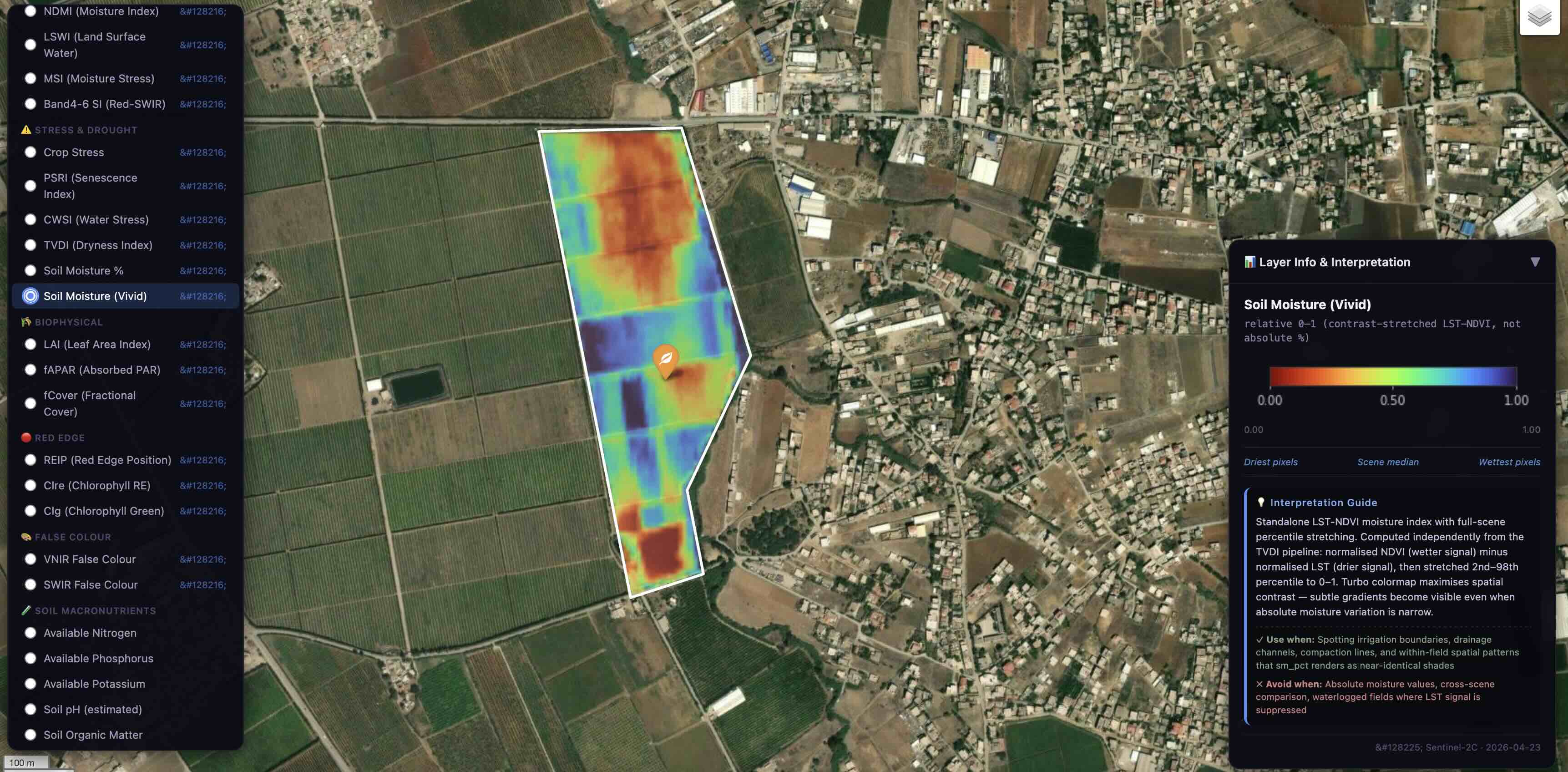
LST-NDVI TVDI. Red = driest, blue = wettest. Reveals irrigation boundaries, drainage issues, and compaction lines invisible to the naked eye.
Years of data. Seconds to insight.
Travel through your field's entire history — watch nitrogen efficiency evolve, track soil moisture across seasons, and replay every agronomic event with full context.
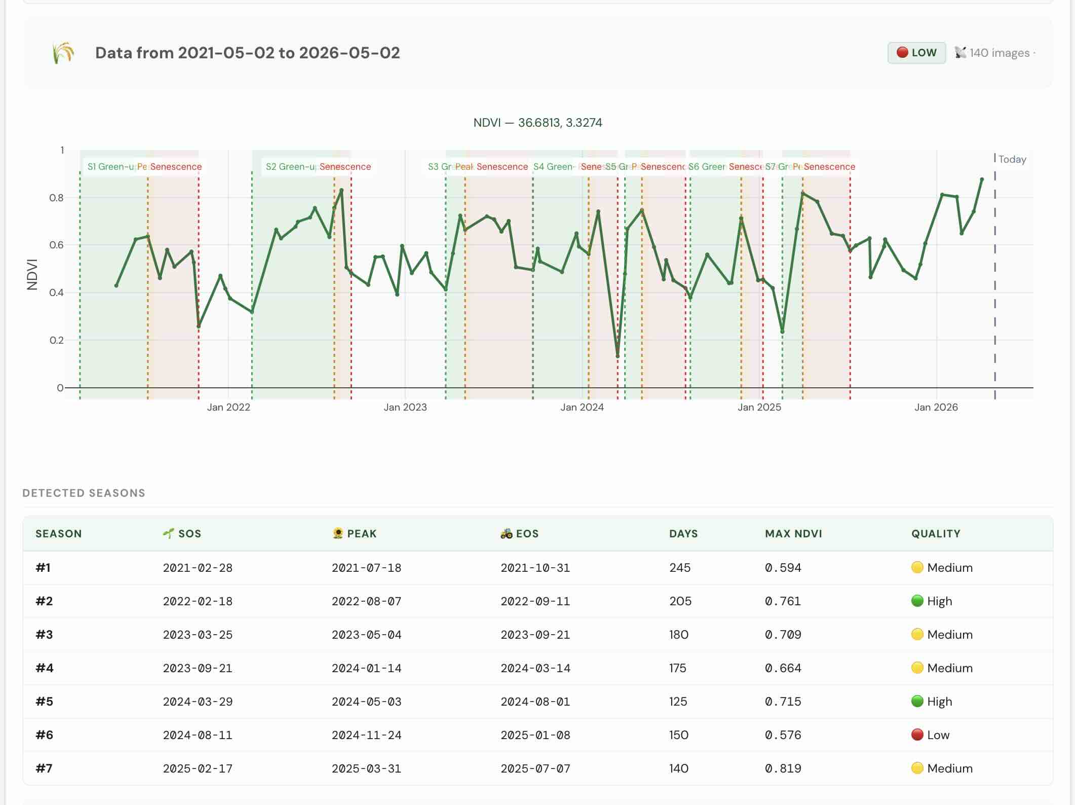
7 seasons detected automatically
NDVI time-series from 140 satellite images across 5 years. Agrocept auto-detects green-up, peak, and senescence for every season — with quality scores, max NDVI, and growing-day counts to benchmark year-over-year performance.
Watch nitrogen efficiency evolve across the season
NUE zone maps at three timestamps reveal where nitrogen was deficient, optimal, or oversaturated — pixel by pixel. Scrub through the season to find exactly when and where to intervene.
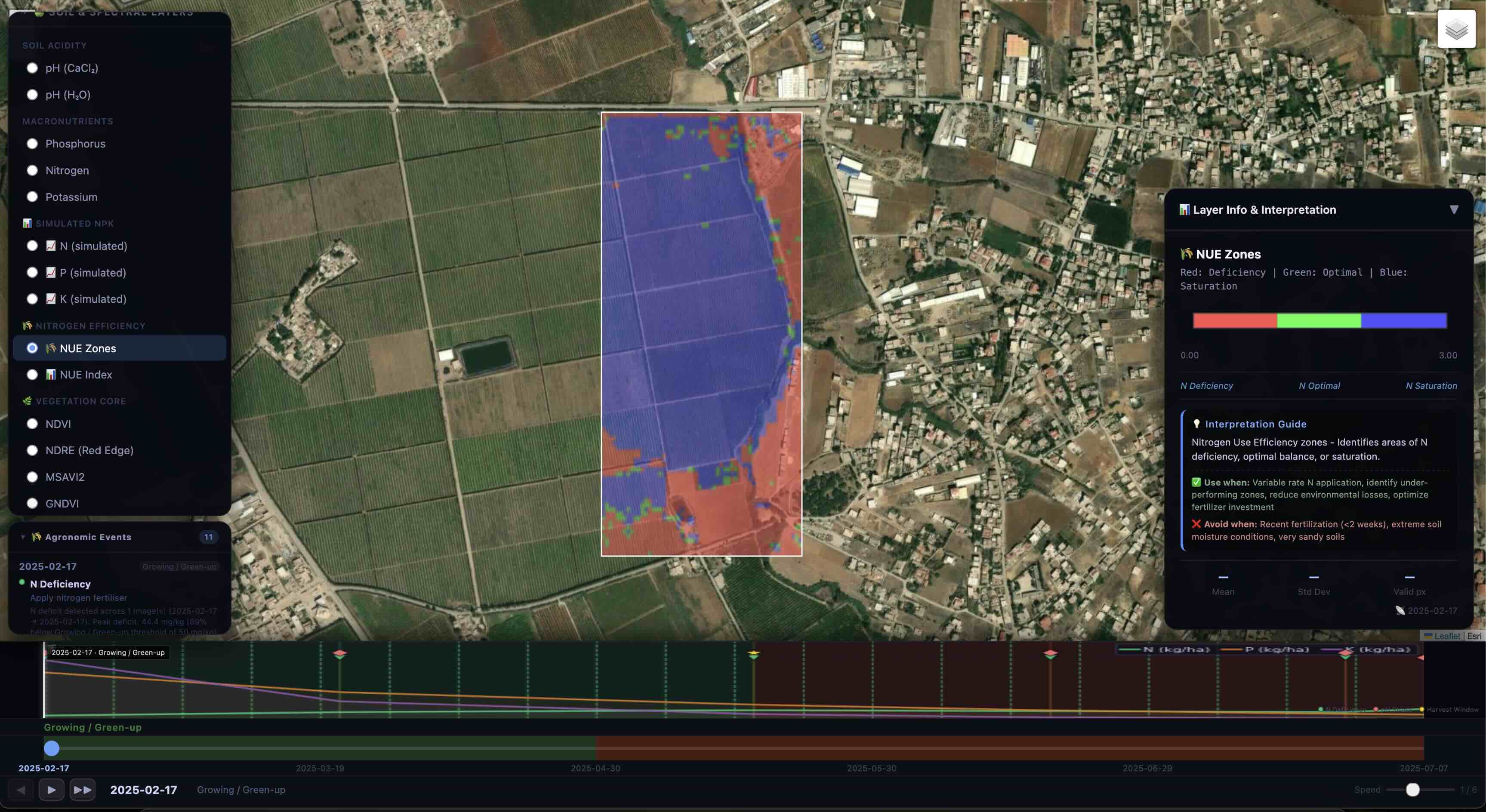
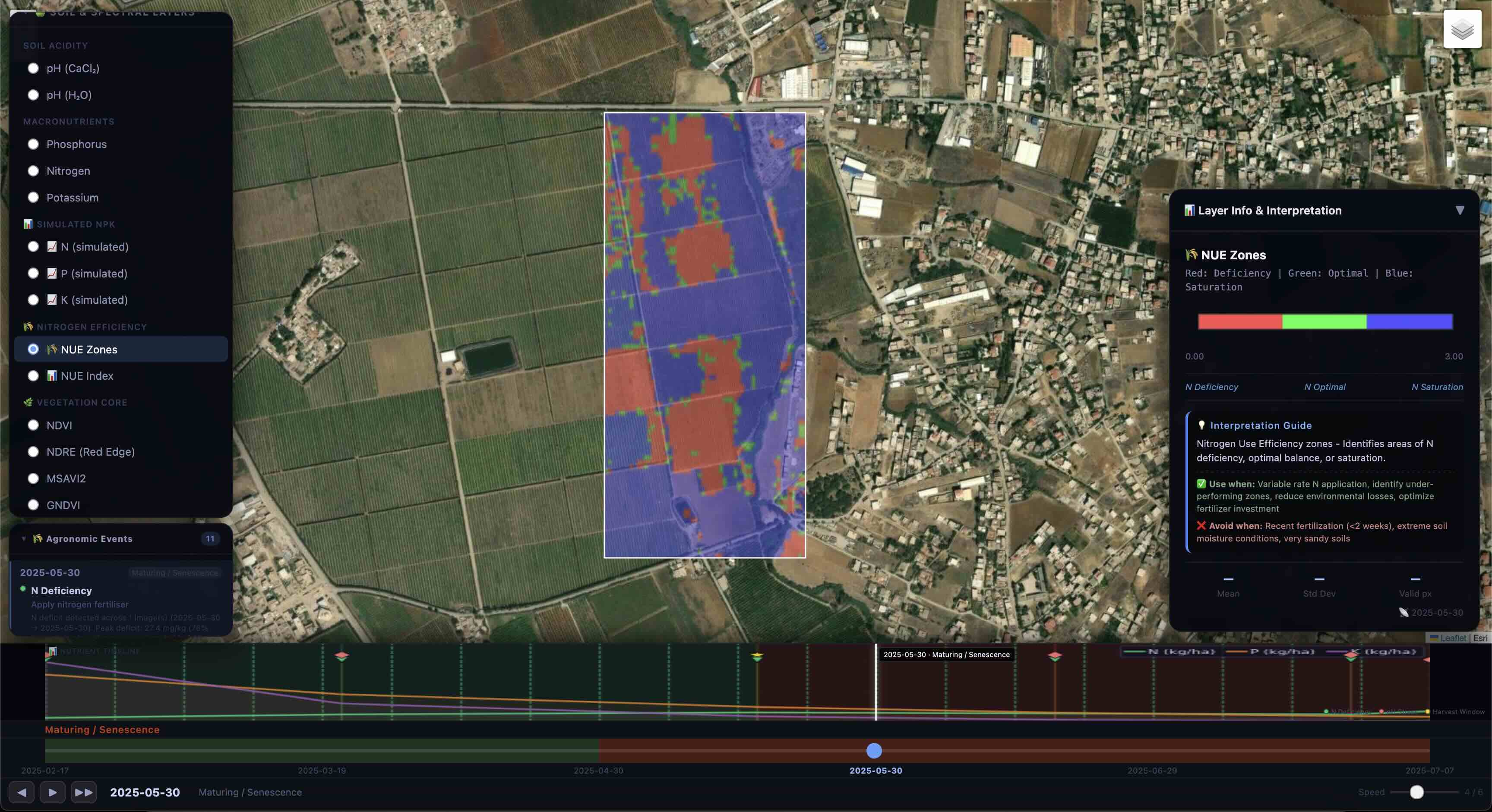
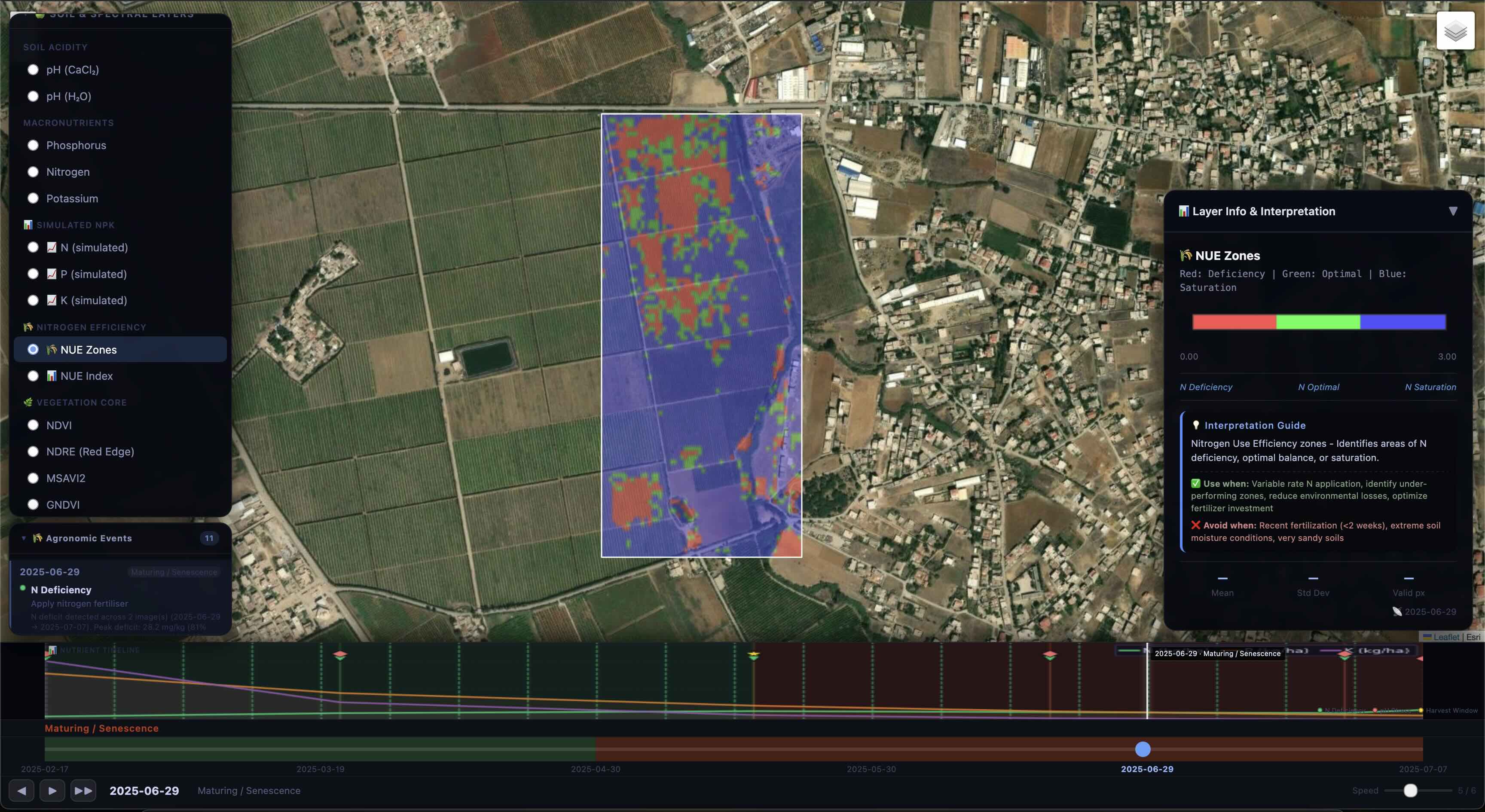
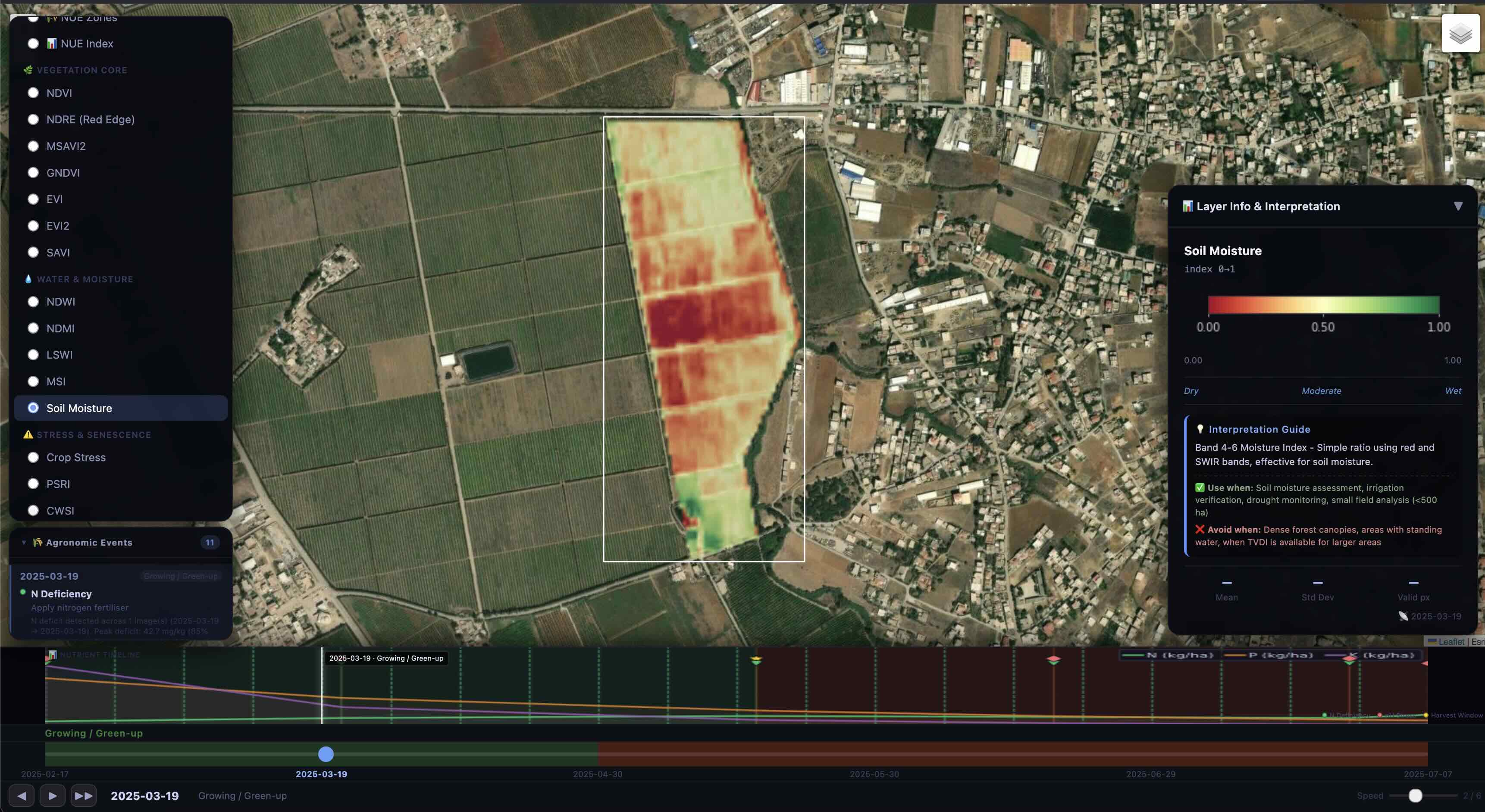
Drought stress — flagged weeks early
The Band 4-6 moisture index on March 19 reveals severe dry stress in the upper field weeks before visible crop symptoms. Irrigation was scheduled in time — preventing an estimated 29% yield loss.
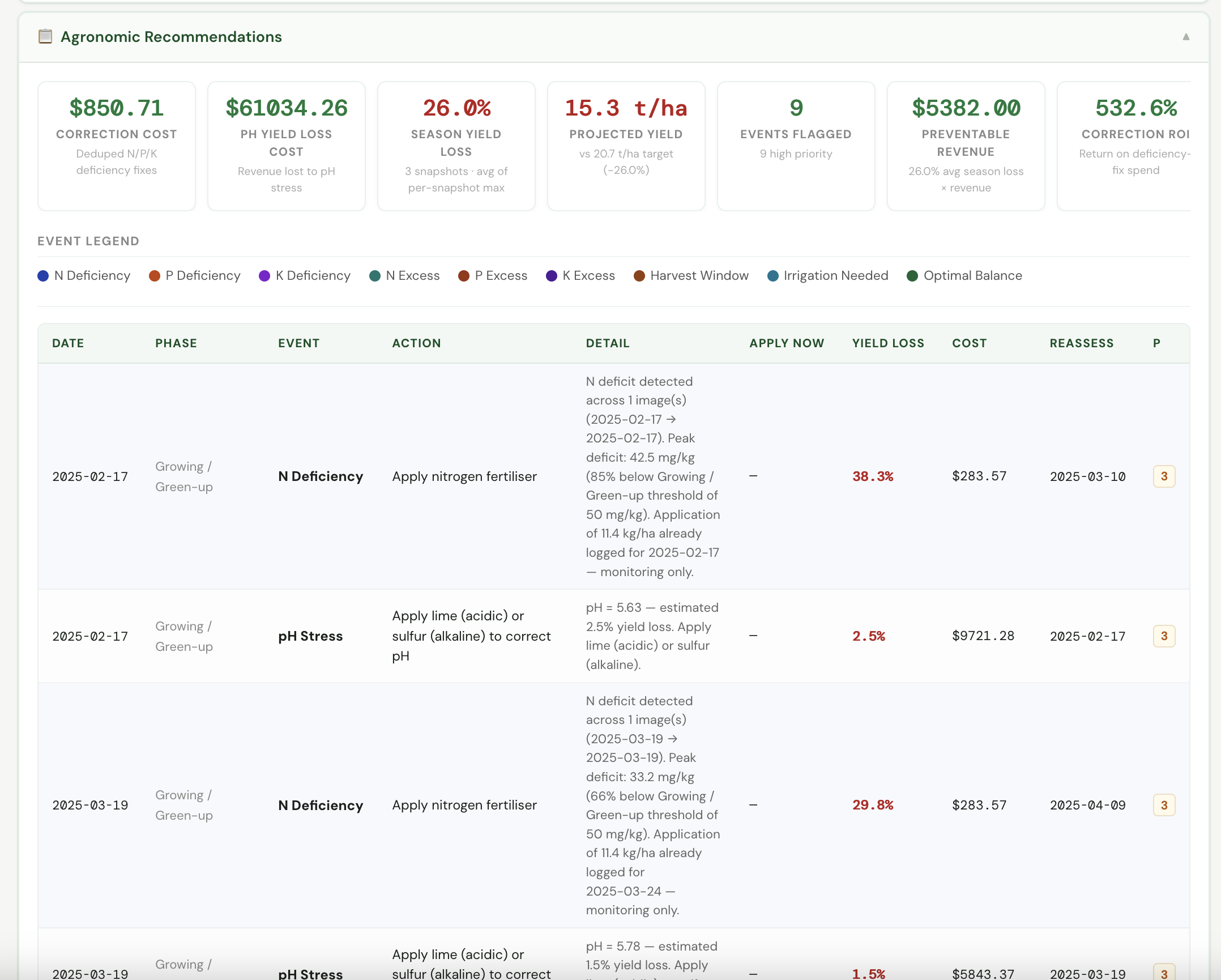
Every event. Every cost. Every ROI.
Agrocept turns satellite data into a full agronomic action log — correction costs, yield loss percentages, and ROI calculations per event. The numbers that justify every recommendation.
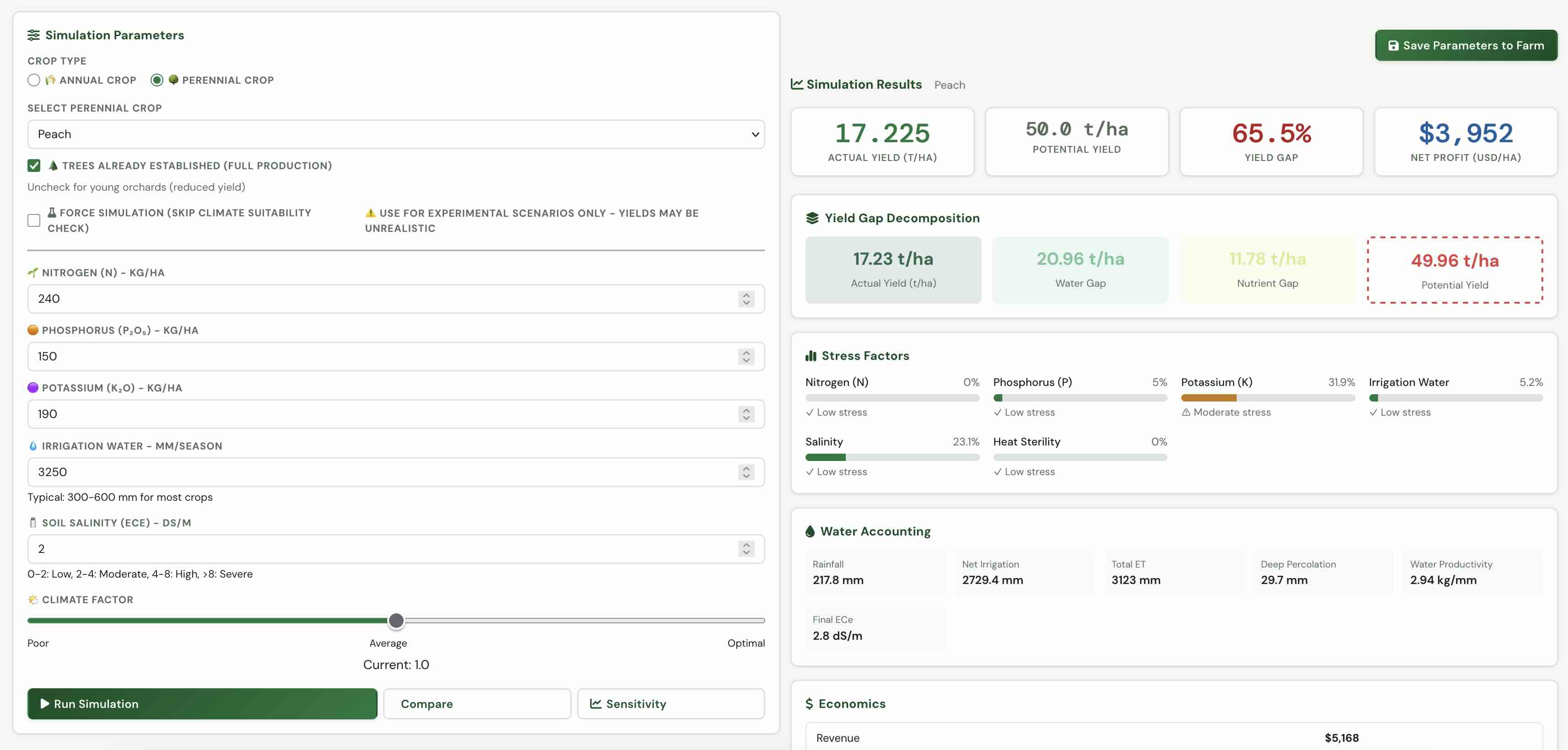
Model the Future of Your Harvest
Agrocept's biophysical simulation engine lets you test any scenario before spending a single input dollar — water, nutrients, climate, and soil all modeled together.
What the simulator reveals
-
Yield Gap Decomposition — see exactly how much potential is lost to water, nutrients, or climate, broken down to t/ha.
-
NPK Sensitivity Analysis — test nitrogen, phosphorus, and potassium levels against yield curves to find your economic optimum.
-
Water Accounting — full season budget: rainfall, net irrigation, total ET, deep percolation, and water productivity per kg.
-
Climate Scenario Testing — simulate drought years, heat events, or ideal conditions to stress-test your farm strategy before the season starts.
-
Economics Built-In — every scenario outputs net profit per hectare, so agronomic choices are always tied to financial outcomes.
By the numbers
From Satellite to Strategy in 4 Steps
Draw Your Field
Mark your farm boundaries on an interactive map — or import from GPS.
AI Analyzes Data
Our models process satellite imagery, weather, and soil data instantly.
Get Insights
Receive yield predictions, stress maps, nutrient recommendations.
Optimize & Act
Apply variable-rate prescriptions and track results over time.
What Our Users Say
"Agrocept helped us reduce fertilizer costs by 28% while maintaining yields. The NDVI maps are incredibly accurate and easy to understand."
"The soil moisture predictions saved our olive grove during a drought. We adjusted irrigation based on Agrocept's recommendations and avoided major losses."
"Being able to analyze 20+ fields in batch mode is a game-changer. The proximity grouping saved us hours of manual work."
Plans for Every Farm Size
Starter
- Up to 3 farms
- Basic NDVI monitoring
- 7-day weather forecast
- Email support
Professional
- Unlimited farms
- Full AI analysis suite
- Yield prediction & stress maps
- Soil nutrient mapping
- Inventory management
- Priority support
Enterprise
- Everything in Professional
- API access
- Custom model training
- On-premise deployment
- Dedicated account manager
Ready to Transform Your Farming?
Join thousands of farmers using AI to grow smarter, not harder.